Erratum to: Automatic calibration for wobble errors in shallow water multibeam bathymetries*
Tianyu YUN , Xianhai BU ,**, Zhe XING , Zhendong LUAN , Miao FAN , Fanlin YANG ,4
1 College of Geodesy and Geomatics, Shandong University of Science and Technology, Qingdao 266590, China
2 National Marine Data and Information Service, Tianjin 300012, China
3 Key Laboratory of Marine Geology and Environment & Center of Deep Sea Research, Institute of Oceanology, Chinese Academy of Sciences, Qingdao 266071, China
4 Key Laboratory of Ocean Geomatics, Ministry of Natural Resources, Qingdao 266590, China
* Supported by the National Natural Science Foundation of China (Nos. 41930535, 41830540), the National Key R&D Program of China (No.2018YFC1405900), and the SDUST Research Fund (No. 2019TDJH103)
** Corresponding author: buxianhai2012@163.com
Erratum to: https://doi.org/10.1007/s00343-021-1283-7
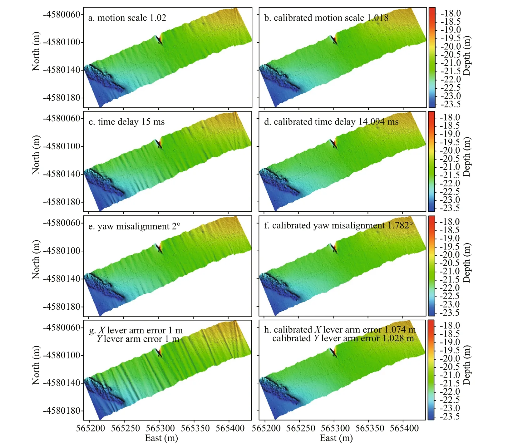
The Fig.9 of this article contains a mistake. The correct one is given below:

Fig.9 Illumination topographic maps before and after calibration of simulated data
 Journal of Oceanology and Limnology2022年6期
- Journal of Oceanology and Limnology的其它文章
- Overview of harmful algal blooms (red tides) in Hong Kong during 1975–2021
- Information standardization for typical toxic and harmful algae in China’s coastal waters—a case study of Karenia mikimotoi*
- Biochemical composition of the brown tide causative species Aureococcus anophageff erens cultivated in diff erent nitrogen sources*
- Identif ication of paralytic shellf ish toxin-producing microalgae using machine learning and deep learning methods*
- Screening for lipophilic marine toxins and their potential producers in coastal waters of Weihai in autumn, 2020*
- First observation of domoic acid and its isomers in shellf ish samples from Shandong Province, China*
