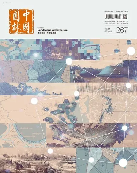
刊首语
时空大数据(spatiotemporal big data)、大数据平台(big data platform)、大数据分析(big data analysis)和大数据应用(big data application)是近年来引起各行各业普遍关注的重要领域,相关的研究成果涉及时空大数据内涵解析与发展机遇、大数据平台构建与数据管理、大数据分析技术与数据挖掘、大数据应用探索与决策支持等多个方面。
在城乡景观规划设计研究领域,时空大数据的应用也逐步受到重视,相关探索性研究既涉及大数据在城乡规划设计领域应用的技术与方法,也涉及大数据时代风景园林的发展和教育;研究范围既有大中尺度的风景名胜区及新型城镇化背景下的城市园林规划设计,也有关注使用者活动方式的中小尺度的城市绿地系统规划设计;特别是在将多种类型的时空大数据应用于景观规划设计的具体案例中,手机信令数据的应用、卫星定位导航(GNSS)数据的应用、社交网络(SNS)大数据的应用、具有地理位置的景观照片(geo-tagged photo)分析,以及基于社会感知大数据的人群行为模式(behavioral mode)分析等,均表现出全方位的时空大数据辅助景观规划设计的态势。
时空大数据的出现为景观规划设计带来了新的机遇和挑战。机遇体现在时空大数据为我们开展景观规划设计提供了全面、系统、定量地分析与认识场地的机会,特别是认识人与场地的关系,因为时空大数据类型多样、内容丰富、特征鲜明,与城乡景观规划设计相关的时空大数据包括2个大类(静态数据与动态数据)、12个中类(基础空间数据、场地资源数据、场地设施数据、社会经济数据、环境效益数据、人流统计数据、动态监测数据、定位通信数据、网络媒体数据、社交网络数据、刷卡消费数据、活动行为数据)、30多个小类;不仅如此,时空大数据具有6个方面的显著特性,即客观性、多源性、动态性、精细性、现势性和人本性,这使得数字景观规划设计迎来新的发展契机。于是,业内不少学者开展了基于时空大数据的景观规划设计探讨,涵盖了基于移动通信大数据的城市公园游客构成及活动分析与规划设计研究、基于定位导航大数据的历史文化景区游客空间行为模式分析与规划设计研究、基于社交网络大数据的城市绿地系统分析与公园绿地规划设计研究、基于环境感知大数据的城市生态系统变迁分析与规划管理研究、基于数值模拟大数据的居住小区建筑布局与环境规划设计研究,以及基于地理标记景观照片大数据的街道尺度景观规划设计等。
在看到探索研究成果的同时,也要关注到景观规划设计领域时空大数据应用面临的挑战,主要体现在2个方面,其一是大数据的获取途径还比较有限,很多的景观时空大数据存储在事业或者企业服务器中,对于广大景观规划设计从业者来说,并没有真正的时空大数据可以随时应用;其二是大数据的处理能力还比较有限,多数景观规划从业人员对于大数据分析和应用的技能还没有达到预期水准,所以也无法在自己承担的景观规划设计研究中尝试应用大数据。然而,面向未来,上述挑战将逐步予以解决,因为国家已经出台了《促进大数据发展行动纲要》,城乡景观规划设计领域已经呈现出以下5个方面的时空大数据应用发展趋势:其一是大数据应用的生态环境逐步构建,其二是大数据应用的技术体系逐步形成,其三是大数据应用的人才力量逐步壮大,其四是大数据应用的多源集成创新发展,其五是大数据应用的人本主义特色体现。基于时空大数据的景观规划设计必将体现人本主义特色,通过大数据辅助分析人的自然、社会、文化、情感等多维特性,然后通过规划设计的手法,在空间、时间、设施、环境等多个维度满足人的需求特性。
最后,感谢清华大学党安荣教授对本期主题文章的贡献。
Spatiotemporal big data, big data platform, big data analysis and big data application are important areas of interest that have drawn the attention of a wide range of industries in recent years. Relevant research results include many aspects such as the big data connotation analysis and development opportunity, the construction and data management of big data platform, big data analysis technology and data mining, big data application exploration and decision support.
In the field of urban and rural landscape planning and design, the application of spatiotemporal big data has also been gradually taken seriously. Relevant exploratory research involves both technologies and methods big data applied in urban and rural planning and design as well as the development and education of landscape architecture in the era of big data. The research range includes both large and medium-sized scenic areas and urban landscape planning and design under new urbanization, as well as small and medium sized urban green space system planning and design that focuses on user activities. Particularly in the cases of the application of multiple types of spatiotemporal big data to the landscape planning and design, the application of handset signaling data,GNSS data, SNS big data, geo-tagged photo analysis, and behavioral mode analysis based on social perception big data, show the situation of the full range spatiotemporal big data aiding landscape planning and design.
The advent of spatiotemporal big data brings new opportunities and challenges to landscape planning and design. The opportunities are reflected in the spatiotemporal big data providing a comprehensive, systematic and quantitative analysis and understanding of venues for our landscape planning and design, especially in understanding the relationship between people and venues, because the spatiotemporal big data are of diverse types,rich contents, and distinctive features, The spatiotemporal big data related to urban and rural landscape planning and design include two large categories (static data and dynamic data), 12 medium categories (basic spatial data, site resource data, site facilities data, socio-economic data, environmental benefits data, people flow statistics, dynamic monitoring data, positioning communication data, network media data, social network data, credit card spending data, and activity data), and over 30 sub-categories; not only that, the spatiotemporal big data has six aspects of significant features, such as being objective, multi-source, dynamic, potential, sophisticated and human-oriented, bringing digital landscape planning and design a new development opportunity. Thus, we see that many scholars in the industry have carried out the discussion on the landscape planning and design based on the spatiotemporal big data, covering the areas of the composition and activity analysis and planning and design of tourists in urban parks based on the big data of mobile communication, the spatial behavior pattern analysis and planning and design research of tourists in historical and cultural scenic areas based on the big data of positioning and navigation, the urban green space system analysis and park green space planning and design research based on the social network big data, the urban ecosystem change analysis and planning management research based on the environmental perception big data, the residential building layout and environmental planning and design research based on the numerical simulation big data, as well as the street scale landscape planning and design based on the geo-tagging landscape photo big data.
While seeing the achievements of exploration and research, we should also pay attention to the challenges faced in the application of spatiotemporal big data in the field of landscape planning and design, mainly in two aspects. One is that the access to big data is still relatively limited, and a lot of landscape spatiotemporal big data are stored in institutional or enterprise servers, and for the majority of landscape design and planning practitioners, no real spatiotemporal big data can be readily applied; the second is the processing power of big data is still relatively limited, and most landscape planning practitioners' skills of big data analysis and application have not yet reached the expected level, analysis, so they cannot try to apply big data in their own landscape planning and design studies. However, facing the future, the above-mentioned challenges will be gradually solved, since the state has promulgated the Action Plan for Promoting Big Data Development, and the urban and rural landscape planning and design field has shown the following five trends in the application of spatiotemporal big data: 1) the eco-environment of big data application gradually building up, 2) the technology system of big data application gradually taking shape, 3) the talent strength of big data application gradually expanding, 4) the multi-source integration of big data application innovatively developing, and 5) the human-oriented characteristics of big data application showing up. The landscape planning and design based on spatiotemporal big data is bound to embody the human-oriented characteristics, help to analyze people’s natural, social, cultural and emotional multidimensional features through big data, and then use planning and design techniques in space, time, facilities, environment, and multiple dimensions to meet the people's needs.
Last but not the least, we are grateful to Professor Dang Anrong of Tsinghua University for his contributions to the thematic papers in this issue.

