基于风貌保护的南京老城城市设计高度研究
为落实南京历史文化名城的风貌传承要求,实现高度控制的法定化,研究以老城40km2内的5569个权属地块为研究对象,采用了法定规划高度控制整合基础上的、城市设计控制与赋值计算双向校核的技术方法。

1 总体城市设计意向/Overall urban design intention

2 轴线与历史街道/Axis and historical street
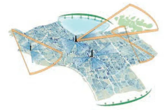
3 视廊与天际线/Vision and skyline
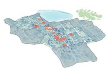
4 高层建筑组团/High-rise building group

5 历史城区/Historic city
其中“法定控高整合”实现了各种相关法规、条例和已批规划设计的高度控制成果整合;“城市设计控制”依据经典美学原理,着眼老城特色风貌结构与感知意象进行重点管控,形成环境品质改善中“管好”的核心内容;“赋值计算”着眼用地高度差异的影响因素与互动,建立基准性数字平台,解决具有基本品质的海量城市高度形态管控基准。“双向校核”以法定控高整合为基准,参照风貌结构意象,会同控详编制单位和规划管理部门共同完成赋值结果的调整与优化,并围绕设计目标和现实问题提出形态协调的措施建议。
研究初步实现了统一各种法定规划中有关高度控制的“一张图”成果;同时考虑老城保护、修补、再
生发展的动力和限制因素,为城市发展的不确定性留出空间,为后续设计与管理留下“有边界”的调适余地。
研究成果最终形成高度视角下的《南京历史文化名城保护规划(2010)》老城空间形态保护深化图则。图则报南京市人民政府批复(宁政复[2017]2号)后,纳入南京市人民政府发布的《南京市老城建筑高度规划管理规定》(宁政规字[2017]3号),并于2017年5月开始施行,为南京老城高度的科学引导与管控提供了依据。□
In order to fulfil the requirements of inheriting the famous historical and cultural styles and features of Nanjing and realize the legalisation of height control, this study took 5,569 ownership plots within 40 square kilometres of the old city as the research object, and adopt a technical method of two-way verification of urban design control and assignment calculation based on the height control measures of statutory planning.

6 控高计算输出图/Height control calculation output diagram

10 历史风貌因子/Historical style factor
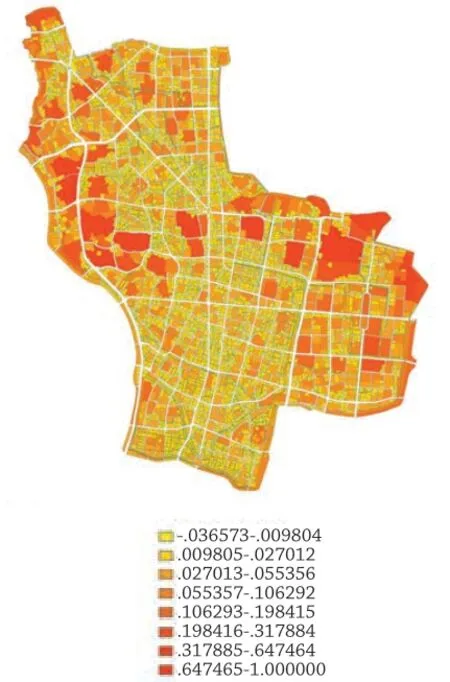
11 用地规模因子/Land size factor

7 用地性质因子/Land use factor

8 轨道交通因子/Rail transit factor
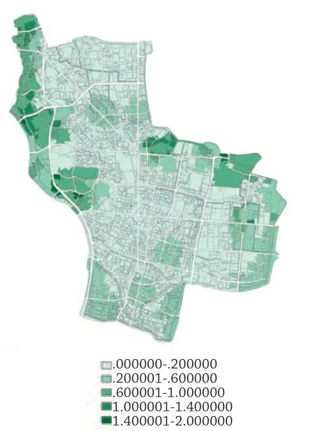
9 绿地因子/Green space factor
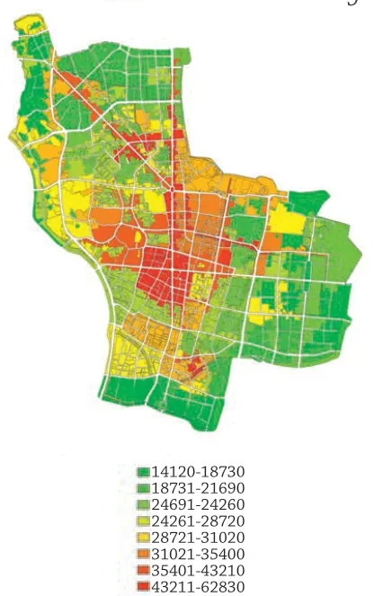
12 地价因子/Land price factor
In the study, the "integration of height control based on statutory planning" realised the integration of various relevant laws, regulations,and building height control results of approved planning and design. "Urban design control" was based on classic aesthetic principles, focusing on the characteristic style and structure of the old city and perceptual image for key management and control, and formed the core content of"good management" in the improvement of environmental quality. "Assignment calculation"focused on the internal factors and mechanisms of land height differences, established a benchmark digital platform, and provided a standard for the management and control of massive urban height forms with basic quality. The "two-way verification"was to integrate various statutory measures of height control as the benchmark, refer to the image of the style and structure, and cooperate with the regulatory detailed planning authorities and the planning administrative departments to complete the adjustment and optimisation of the assignment results, as well as putting forward proposals and countermeasures of form coordination focusing on the design goals and practical problems.
The study preliminarily realised the unification of the "one map" results related to height control in various statutory planning. Moreover, considering the impetus and restrictive factors of the protection,repair, regeneration and development of the old city,it provided possibility for the uncertainty of urban development and left an adjustable "boundary" for subsequent design and management.
The research results finally formed the deepening plan for the protection of the old city's spatial form in the "Nanjing Conservation Plan of Historical City (2010)" from the height perspective. After being submitted to the Nanjing Municipal People's Government, the plan was approved (Nanjing Administrative Approval [2017] No. 2), and then included in the "Nanjing Old City Building Height Planning Administrative Regulations" (Nanjing Administrative Provision [2017] No. 3) issued by the Nanjing Municipal People's Government, which was implemented in May 2017, playing an important role in realising the scientific guidance and control of the height of the old city in Nanjing.□
项目信息/Credits and Data
设计团队/Design Team: 王建国,高源,张愚,杨志,李京津等/WANG Jianguo, GAO Yuan, ZHANG Yu, YANG Zhi,LI Jingjin, et al.
项目规模/Scale: 40 km2
设计时间/Design Period: 2015-2016
专家评审会意见
为实现南京历史文化名城保护与古都风貌彰显、落实老城功能疏解和容量控制发展战略、为老城地块高度控制法定化提供技术支撑,结合新形势要求,开展该研究是十分必要和及时的。编制单位现状调研深入,技术路线清晰,内容丰富,研究方法科学客观,具有创新性和可操作性,是一项具有国内领先水平的研究成果,并为后续工作开展奠定了良好的基础。
Jury's Comments
The importance and necessity of carrying out this research is evident in the following aspects: to meet the requirements of the new situation, to realise the protection of the historical and cultural city of Nanjing, to display its features as an ancient capital, to implement the development strategy of the function of the old city and the capacity control, as well as to realise the legalisation of the height control of the old city. The compilation unit conducted in-depth research on the current situation, adopted a clear technical route. In view of the rich content, the scientific and objective research method, which is innovative and manoeuvrable, it is considered a domestic leading research result, and has laid a solid foundation for the follow-up work.
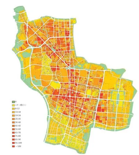
13 高度控制总图/Height control master plan

15 高度分布结构三维图/3D map of highly distributed structure
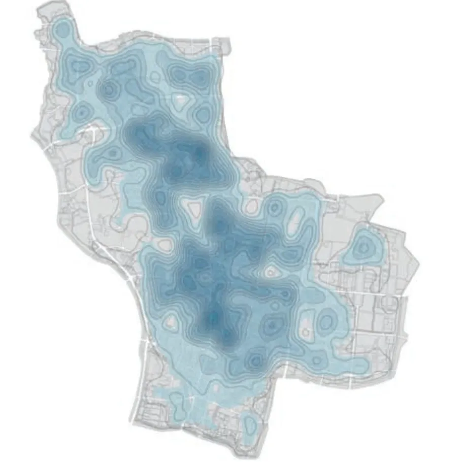
14 高度分布结构平面/Height distribution structure plan
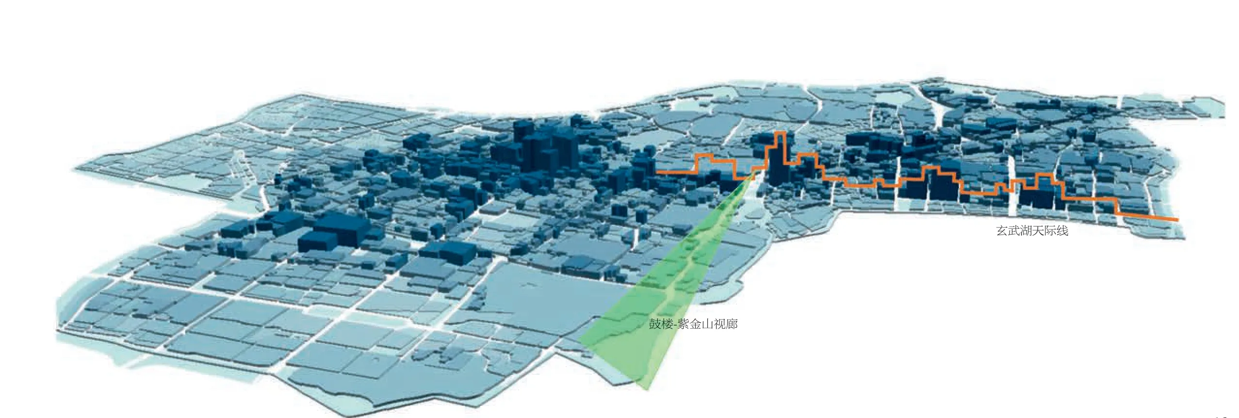
16 高度控制结果分析————东北方向形态/Analysis of height control results: northeast form

17 玄武湖天际线设计意向/Xuanwu Lake skyline design intention

18 设计成果实施6年后的玄武湖天际线/Xuanwu Lake skyline six years after design implementation(摄影/Photo: 王建国/WANG Jianguo)

