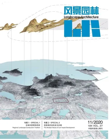
区域风景营构传统

早在金代,北京初定为中都时,如何获得巨大的水源(尤其是漕运水源)是营城和治水的关键,时人的做法极具智慧,即将西山玉泉山泉水引入海拔50 m瓮山泊一带蓄积为水库,并挽而向南,人工开凿海拔52 m的海淀台地,导西山水系穿海淀台地引向东南,为长河。到元代,高梁河水系成为都城命脉,由开凿的长河和高梁河接引而成通惠河。广源闸是节制长河之水的关键,闸上游直通瓮山泊,并沿着引水渠到昌平白浮泉,闸下游经紫竹院、乐善园至西直门穿城而入,出东便门外的大通桥,经通州八里桥与北运河相连,构成了引水贯都的大运河北京段。古时漕运似今天的高速公路,承载南北的物资转运,城中积水潭(又称什刹海)成为京杭大运河的终点码头,逐渐形成大都最大的商业繁华区,桅杆林立,舳舻蔽水。明代积水潭转变为城中公共性风景胜地,清初成为官宦公用的园囿并逐步恢复商业繁荣。积水潭前、后海相连处的银锭桥是衔西山、扼近水的风景佳构,燕京小八景“银锭观山”所在,对观的远山即为“西山晴雪”景,形成西山、积水潭和城中心码头商业区间的“山—水—城”互为因借之势。经大运河北京段持久的风景营构,沿岸风光旖旎,上游瓮山泊扩建为昆明湖,下游营造琼岛春荫、太液秋风、长桥映月等诸多景致与胜迹。

通过人工对自然持久干预,在顺应自然的基础上有效梳理,向着更有利于人居的方向引导与建构,形成区域风景系统。包括了自近郊延伸至城市的浅山体系、经人工干预整理沟通城市内外的水网河湖体系等,构成了城市发展的生态本底。城市处于区域风景系统之上,依循着自然山水进行选址、分区营建,营造城内园林和城外风景,让自然环境与人工环境相互适应、耦合。区域风景系统的演变深刻影响城市的形态、格局与发展;而城市的营建与社会活动又促进区域风景系统的不断经营完善,达到动态平衡而持久韧性地发展,经过人工介入、人文渗透与自然系统相适应而重塑,最终形成自然与人文交织、风景与文化并存的人居环境。
可见,城市发展和自然环境不应是针锋相对,而应是相互适应、相互促进。区域风景系统体现了连接自然与人文的生态智慧,构成了人居环境生态本底、风貌特色和安全韧性3方面的支撑系统,也是诗意栖居的重要载体。研今必习古,中国人居环境营建的时空发展脉络极为丰富与复杂,对区域风景系统营构传统中展现的人与天调的智慧与精妙进行解析,在因地制宜、师法自然的基础上做好人居环境营建的传承,维护好区域风景系统的格局,让城市更生态、更具特色、更可持续意义重大。
将区域风景系统提升到国土空间范畴,作为协调自然与人工的重要手段,能够有效整合多层次、多功能的复杂关系,统筹生态空间、生产空间和生活空间,使城市浸润在自然山水之中,延续城郊一体的区域风景系统的完整性,将更有利于实现持久繁荣发展。
主编:郑曦教授
2020年10月28日
PREFACE
Regional Landscape Construction Tradition
As early as Jin (金) Dynasty when Beijing was first determined as its capital, how to ensure a large amount of water source (especially water source for grain transporting) meant a challenge for water control and also for urban construction.However, people at that time were so wise that they led the spring of Yuquan Hill in the Western Hill to Wengshan Lake like a reservoir with an altitude of 50 m and was led further southward. A Haidian plateau with an altitude of 52 m was also explored artificially to lead the water from the Western Hill to the southeast, which formed the Long River crossing the plateau. In Yuan Dynasty, the Gaoliang River network became the core of the city. It, together with the Long River, constituted Tonghui River.Guangyuan Gate was playing a pivotal role in controlling the water of the Long River and Wengshan Lake could be reached through the upstream of the gate. Along the diversion canal, the Baifu Spring in Changping could be reached as well. The downstream of the gate runs through the whole Beijing City via Zizhuyuan Park,Leshan Park and Xizhi Gate, runs out of the city to Datong Bridge in Dongbian Gate and then connects the North Canal through Bali Bridge in Tongzhou. The whole river constitutes the Beijing Section of the Grand Canal which introduces water to the capital.The canal used for transportation in ancient times seems like today’s highway responsible for transferring materials between the North and the South. Jishuitan Lake (also called Shichahai Lake) in the downtown became the end wharf of Beijing-Hangzhou Grand Canal, where the biggest commercial area in the city was formed,used to be scattered with lots of masts and ships nearly covering the whole lake. Then Jishuitan Lake became a public scenic spot in the city in Ming Dynasty and a public garden for of ficials at the early stage of Qing Dynasty and therefore the commercial activities there recovered successively. Yinding Bridge that connects Qianhai Lake and Houhai Lake of Jishuitan Lake is actually a marvelous scenic spot connecting the Western Hill and the water nearby and is also where “Mountain Viewing from Yinding Bridge”, one of the eight scenes in Yanjing (former Beijing) is located. The distant mountain on the opposite constitute the scene of “Sunny Western Hills after Snow”, which altogether forms the whole structure of“mountain-water-city” including the Western Hill, Jishuitan Lake and the commercial area of the downtown wharf. The landscape along the banks of Beijing Section of the Grand Canal became picturesque and attractive after the cultivation for a long period of time. Wengshan Lake in the upstream was then expanded into Kunming Lake while several beautiful scenes were designed in the downstream such as the scene of “Shady Spring of Qiongdao Island”, “Autumn Breeze of Taiye Lake”, “Moonlight Reflection in the Long Bridge”, etc.
Through people’s intervening with the specific purpose, nature could be sorted effectively on the premise of abiding by the law of nature and is guided and built by to better satisfy people’s dwelling demand. Finally, a regional landscape system is formed, including the shallow mountain system stretched into the city from suburb and the water network system connecting the inside and outside of the city, etc., all of which serve as the ecological basis of urban development. The city was developed based on regional landscape system and according to its natural landscape in all aspects, including its site selection, zoning development and the whole landscaping inside and outside the city, so as to better coordinate and integrate the natural and artificial environment. The evolution of regional landscape construction influences the spatial form, pattern and development of a city significantly. Also, city construction and social activities boost the continuous improvement of regional landscape system so as to strike the dynamic balance and lasting resilience. City is reshaped through artificial intervening, penetration of humanism spirit and adapting to natural system, finally forming a human living environment where nature develops with human and landscape coexists with culture.
Thus urban development and natural environment should not be on the opposite of each other, but should adapt to and promote each other. Regional landscape system reflects the ecological wisdom of integrating artificial intervention and the nature, constitutes three basic supporting systems, including the ecological background, the characteristic features and safety resilience of the living environment, which are also the important carrier of poetic dwelling. Studying current issues must be based on the past experience. The temporal-spatial development process for the construction of China’s human living environment is abundant and diverse. The analysis of the wisdom and subtlety of the harmonious relation between man and nature in the traditional regional landscape system construction is critical to inherit the construction tradition of human living environments, to maintain the regional landscape system and to make city more distinguished,eco-friendly and sustainable on the basis of the local conditions and nature.
The regional landscape system should be lifted up to the level of national land structure organization, being utilized to coordinate the artificial and natural elements, integrating the complex spaces with multilayers and multifunction, unifying ecological spaces,production spaces and living spaces, allowing the city embedded in its natural landscape. The extension of the integrated regional landscape system of the urban-suburb unity would contribute to the lasting prosperity.
Editor-in-Chief: Professor ZHENG Xi
October 28, 2020

