
Introduction to marine emergency forecasting and early-warning system(MEFES)
2020-08-12 00:57:00XUShanshanLIHuanLIChengWANGGuosongZHANGZengjianPANSong
Marine Science Bulletin 2020年1期
XU Shanshan,LIHuan,LICheng,WANG Guosong,ZHANG Zengjian,PAN Song
National Marine Data and Information Service,Tianjin 300171,China
Abstract:Marine emergencies especially oil spill may bring irreversible harm to the marine environment,and will cause immeasurable economic losses.In recent years,the demand for crude oil is increasing year by year in China with the high-speed economic development,leading to the high risk of marine oil spill.Therefore,it is necessary that promoting emergency response on marine oil spill in China and improving oil spill forecasting and early-warning techniques.This paper introduces the Marine Emergency Forecasting and Early-warning System(MEFES)developed by National Marine Data and Information Service(NMDIS).The system consists of one database,two modelling subsystems and a GIS platform.The database is the marine emergency database,and two subsystems include the marine environmental forecasting subsystem and the oil spill behaviour forecasting subsystem.MEFES has been applied in the emergency response of some major oil spill accidents occurred in recent years.The operational applications of the system can provide some theoretical basis and reference for marine oil spill emergency response.
Keywords:oil spill,numerical model,forecasting and early warning system
1 Introduction
Marine emergencies especially oil spill have deep negative effect on both marine ecosystem and human activities.In recent years,’with the high-speed economic development,the demand for crude oil is increasing year by year in China,leading to the high risk of marine oil spill.On July 16,2010,an oil spill occurred in Dalian Xin-gang Port,with more than 1 500 tons of oil spilled into the water.The spill has seriously affected local fisheries,aquaculture,tourism and shipping industry and caused huge economic losses to Dalian.On January 6,2018,a serious oil spill occurred in the East China Sea(ECS)due to the Panamanian tanker ship‘SANCHI’accident,and the oil spill pollution had seriously damaged to the marine environment in the ECS.Therefore,the study on marine oil spill emergency technology,especially oil spill forecasting and early-warning technology,and oil spill emergency response capacity are very urgent and necessary.It is not only important to the marine environment safety in China seas,but also has a certain impact on the stable development of China's economy and society.
At present,some oil spill model systems have been used to quickly forecast oil spill drift and diffusion,which can provide technical support for the oil spill emergency departments,so that based on the technical assessment and risk analysis of oil spill accidents they can timely make emergency response.However,for the whole China seas,the existing operational forecasting system can’t meet the requirements of regional integration,and the forecasting timeliness will be missed.Therefore,National Marine Data and Information Service(NMDIS)researched and developed the Marine Emergency Forecasting and Early-warning System(MEFES).With integrating multiple databases and numerical modelling subsystems,the system has been applied in the emergency response of some major oil spill accidents occurred in recent years.The operational applications of the system can provide some theoretical basis and reference for marine oil spill emergency response.
2 System composition
MEFES consists of one database,two modelling subsystems and one GIS platform.The database is the marine emergency database,and two subsystems include the marine environmental forecasting subsystem and the oil spill behaviour forecasting subsystem.Fig.1 shows the structure and work flow of MEFES.
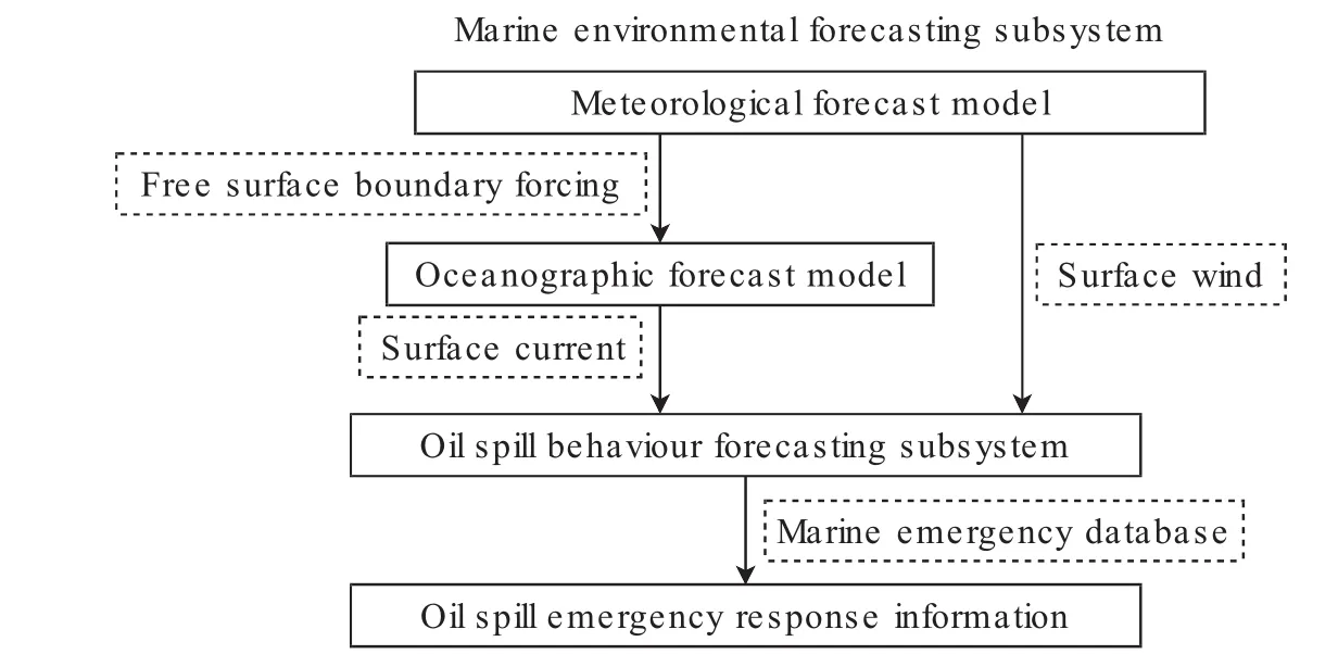
Fig.1 The structure and work flow of the system
2.1 Marine emergency database
This database contains the dynamic and static,spatial and non-spatial data required for oil spill forecasting and early-warning,including basic geographic information sub-database,marine environment information sub-database,and oil property sub-database,etc.Before data loading,the following steps should be proceed in order:(1)data collection and reception;(2)decoding and interpretation;(3)quality control;(4)numerical correction;(5)format conversion;(6)fault-tolerant processing;(7)spatio-temporal alignment;and(8)data association.
2.1.1 Basic geographic information sub-database
Through the loading management of the basic geographic information(such as electronic chart data)of the China seas,the basic geographic information sub-database is built to provide basic map and spatial data analysis support for the display of oil spill drift information based on GIS platform and the basic geographic information management module of the modelling system.
Fig.2 High precision topographic data of the China seas after processing
2.1.2 Marine environmental sub-database
The data collected by the sub-database include high-precision real-time meteorological and hydrological data such as wind,current,SST,etc.,so as to support the call of the marine environmental forecasting subsystem and the calculation of the marine dynamic environmental factors.Fig.3(a)and Fig.3(b)show the forecasted wind and current data which have been loaded in database.
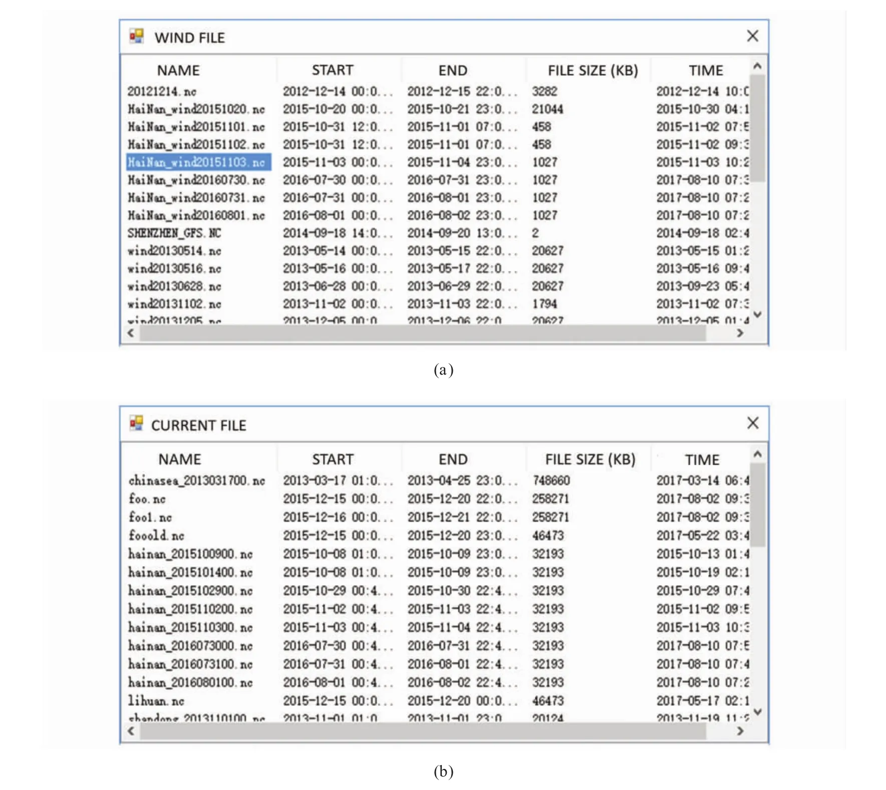
Fig.3 Forecasted wind and current data in the marine environmental database
2.1.3 Oil property sub-database
This sub-database includes data on the types and properties of common oil products in marine oil spills.The oil spill properties mainly include physical and chemical aspects,such as oil density,viscosity,surface tension,evaporation constant and other parameters that affect the oil behaviour and destination in the water.This sub-database mainly provides data support for the oil weathering simulation in the oil spill behaviour forecasting subsystem.
2.2 Marine dynamic environmental forecasting subsystem
In this subsystem,a meteorological and oceanographic forecast model has been coupled for data information exchange.The outputs from the meteorological forecast model can provide free surface boundary conditions to drive the oceanographic forecast model.Meanwhile,the results from meteorological and oceanographic models can provide marine environmental information to the oil spill behaviour forecasting subsystem for forecasting.
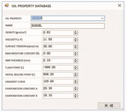
Fig.4 Parameter interface of oil property sub-database
2.2.1 Meteorological forecast model
In this subsystem,WRF(Weather Research and Forecast model)has been adopted as the meteorological forecast model.WRF is a fully compressible,non-hydrostatic model.Its vertical coordinate is a terrain-following hydrostatic pressure coordinate.The grid staggering is the Arakawa C-grid.This model uses the Runge-Kutta second and third order time integration schemes and second to sixth order advection schemes in both horizontal and vertical directions.It uses a time-split small step for acoustic and gravitywave modes.The dynamics conserves scalar variables[1].Due to the shared source codes and quick version update,WRF is widely used in meteorological forecasting and numerical studies.
For high-resolution operational forecasting,a triple-nested simulation scheme was designed in this study.In this scheme,three nested domains with 33,11 and 3 km grid spacing were configured.As shown in Fig.5,the first nested domain with coarser grid spacing(33 km)was configured to cover the East Asia;the second nested domain with refined grid spacing(11 km)was configured to cover the China seas;finally the third nested domain with more refined spatial resolution(3 km)was configured to cover those focused high-risk areas such as harbours,waterways and offshore drilling platforms in the China seas.
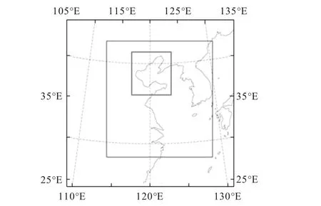
Fig.5 Triple-nested simulation scheme in WRF
2.2.2 Oceanographic forecast model
In this subsystem,SELFE(Semi-implicit Eulerian-Lagrangian Finite Element Model)has been adopted as the oceanographic forecast model.SELFE is an open-source community-supported modelling system based on unstructured grids,designed for the effective simulation of 3D baroclinic circulation across river-to-ocean scales[2].It uses a semi-implicit finite-element Eulerian-Lagrangian algorithm to solve the Navier-Stokes equations[3].It is not required to follow CFL stability constraints[4].That means a large time step can be applied.
In the model,the grid resolution in most of computing areas is 10 km.But for the irregular and complex geometries and priority areas,e.g.coastal areas,harbors and the adjacent waters around oil drilling platforms,the grid was refined to 100 m,further to 50 m(in Fig.6).Apparently,the refined grid could well describe the real terrain of the China seas.When the model running,the surface atmospheric forcing was provided by WRF,and the tidal forcing at open boundaries were provided by the Oregon State University Tidal Data Inversion Software and global tide forecast model.

Fig.6 The grid configuration in the adjacent waters around oil drilling platforms
2.3 Oil spill behaviour forecasting subsystem
In this subsystem,the empirical formula developed by Lehr et al.[5]has been adopted to computer oil spreading.In this formula,the oil slick area is represented as:

where S is oil slick area,M and N are lengths of the minor and major ellipse axis respectively,given by:

whereρwis water density,ρois oil density,V0is the initial volume of spilled oil,t is the time after oil slick commences spreading(min),Uwindis wind speed.Let the concentric and similar ellipse on which the particle is located have major and minor axes n and m,withIf the coordinates of the particle relative to the principal axes of the ellipse are(X,Y),whose x-axis is selected in the direction of the wind,here write X=n cosθand Y=m cosθ.Then the oil particle is displaced outwards with the same elliptical angleθ,as follows[5]:

In this subsystem,the drift and diffusion of spilled oil is solved by tracking a mass of oil particles equivalent to oil slicks.The position of each particle is affected by surface winds,water currents and turbulent dispersion.The forecast model solves the following equation:


where D is the diffusion coefficient.
2.4 GIS platform
Since GIS can integrate a large number of marine,coastal,and oil production or transportation data,in MEFES,component GIS embedded with DLL based on Arc-Engine controllers under Visual Studio.net program language circumstance has been developed.
Based on the GIS platform,some oil spill information such as wind,surface current,and oil transportation or diffusion can be displayed timely.Once an oil spill accident has occurred,the vector maps will be analysed to see what the major concerns are.Fig.7 showed the information about surface currents on GIS platform.
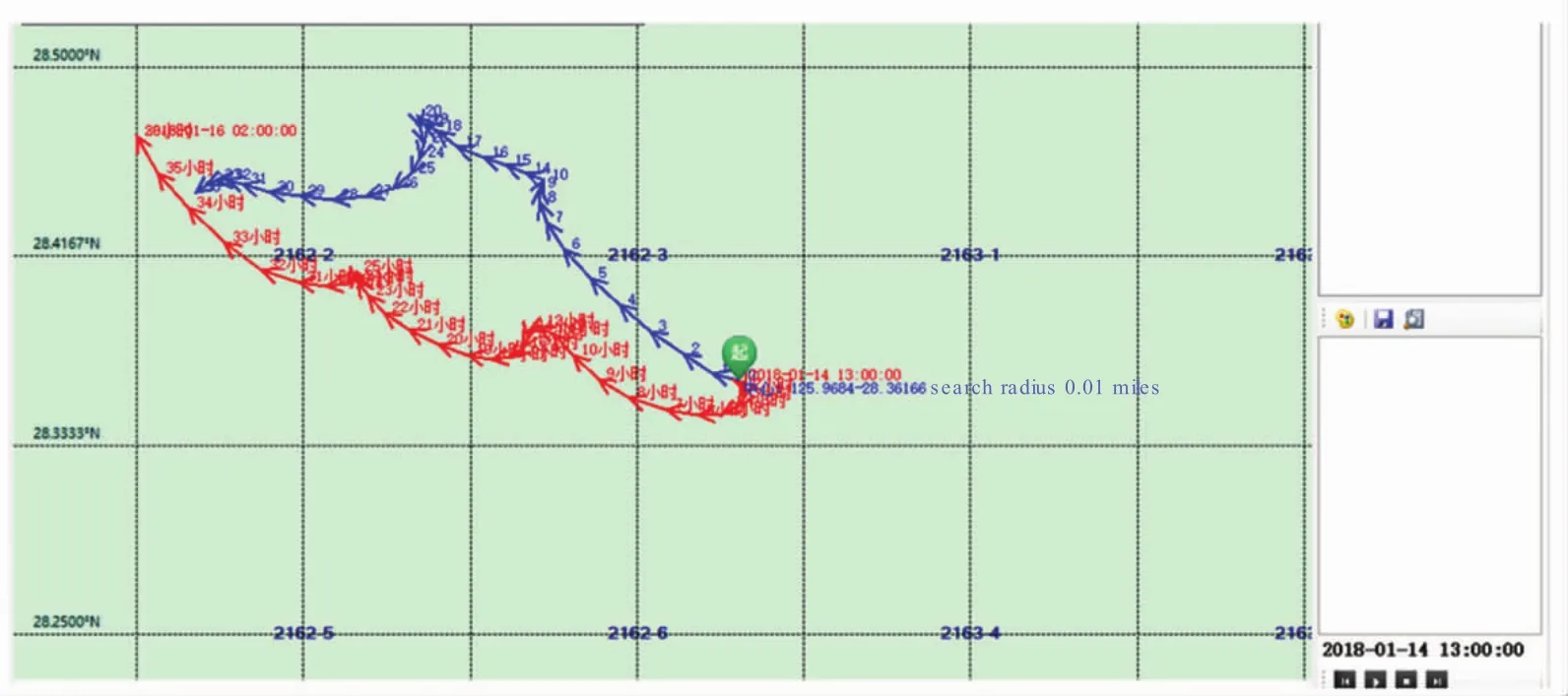
Fig.7 The information about oil transportation on the GIS platform
3 Conclusions
It is necessary that promoting emergency response on marine oil spill in China and improving oil spill forecasting and early-warning techniques.In this paper,the Marine Emergency Forecasting and Early-warning System(MEFES)developed by NMDIS which consists of one database,two modelling subsystems and a GIS platform The system has realized the function of integrated data information exchange between database and simulation models.When forecasting and early warning,the meteorological forecast model will provide free surface boundary conditions to drive the oceanographic forecast model.Meanwhile,meteorological and oceanographic models will provide the dynamical parameters of surface winds and currents for the oil spill drift and diffusion forecasting quickly.The system has been applied in the emergency response of some major oil spill accidents occurred in recent years.The operational applications of the system can provide some theoretical basis and reference for marine oil spill emergency response.
 Marine Science Bulletin2020年1期
- Marine Science Bulletin的其它文章
- Research progress of micro(nano)plastics in marine survey in China
- Bibliometric analysis of Ecopath model in different ecosystem in China
- The benthic diatom community of Xiangshan Bay
- An overview of studies on marine macrobenthic community structure and biodiversity in the Bohai Sea
- Effect of mangrove forest on coastal hazards reduction
- Estimating shoreline response to sea level rise:the equilibrium model